Live Street Camera View
- 13.40K
- 3.4
- Installs
- 5.00M
- Price
- Free
Screenshots





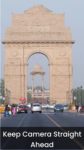
Analysis by Reviewed APKs
Live Street Camera View is a maps and exploration app for people who want to browse places around the world, check map views, and look for routes or weather information from a phone. Its mix of street imagery, satellite views, navigation, and webcams gives it several jobs in one place. My overall take is that it sounds most useful for casual virtual exploring, though I would keep expectations measured about what “live” views can show.
A quick armchair getaway
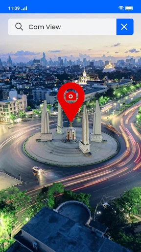
When I want to get a feel for a place before deciding whether to visit, I tend to bounce between a map, a route search, and photos. Live Street Camera View brings those ideas together: I can look up a destination, explore its map or street view, and check whether a camera view or weather information is available. That makes it an appealing app to open during a spare few minutes rather than a tool that demands a carefully planned session.
Picture a weekend trip taking shape over breakfast. I could search for an area, inspect the map, and use the route-finding features to think through how to get there. If the app offers a relevant public or beach camera, that may add a different perspective from a flat map. The appeal is the quick change between exploring and planning; I would still treat map and camera views as context, not a substitute for checking details before leaving.
Maps first, not a travel guide
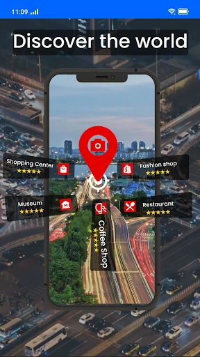
The closest alternatives are familiar map and navigation apps, plus services devoted to webcams or weather. Live Street Camera View tries to cover several of those interests together, with satellite and 3D map views alongside route search, traffic information, weather updates, and camera viewing. That broad mix can be convenient when I am just curious about a location and do not want to switch among several apps for a first look.
That same breadth means I would not treat it as a full travel-planning service or assume every destination has a useful live camera feed. The description promises worldwide exploration and live views, but the practical experience depends on what is available for a particular place. It is better suited to browsing and getting oriented than to replacing a dedicated navigation app or providing definitive, continuously updated information for a trip.
Small habits for better browsing
I get more from apps like this when I start with a specific place instead of tapping around without a goal. A neighborhood, landmark, hotel area, or beach gives the map search a clear target. From there, I can compare the satellite or 3D view with a street-level view, then look for a route or camera option. That simple sequence keeps the app’s many advertised angles from feeling like a jumble of unrelated features.
For trip prep, I would use it as one step in a small routine: check the area on the map, look for traffic or weather information, and then use route search to explore a possible journey. For casual virtual sightseeing, I would skip the route and browse landmarks or places I have heard about. Keeping those tasks separate makes it easier to judge whether a view actually answers my question, rather than expecting every feature to work everywhere.
More From Our News Desk

Zoom Meetings, Google Meet, or Teams: Which Is Easiest to Join?

How I Build a Free Streaming Lineup With Tubi

Why Crunchyroll Is the Default Anime App for So Many Fans

YouTube TV: A Practical Guide to Cutting Cable

Rummikub and the Small Comfort of Phone Games

TeamViewer Remote Control or AnyDesk for Helping Family?
Who may enjoy exploring
I would recommend Live Street Camera View to curious travelers, armchair explorers, and people who like switching between map perspectives while researching a place. Its combination of street and satellite views, location search, route tools, weather information, and webcam viewing gives casual browsing plenty of directions to go. It may also suit someone who wants a quick visual orientation before a visit, without expecting a complete itinerary or a specialist navigation tool.
It may be less satisfying for anyone who needs consistently detailed directions, dependable live camera coverage of a specific spot, or a tightly focused app with just one job. The Play Store rating is 3.4 from around 13,400 ratings, so I would approach it with a practical mindset and try the features that matter to me. Ads and in-app purchases are also part of the package, which may bother people who prefer an uninterrupted, no-purchase experience.
Live Street Camera View is made by Quality App Zone and is listed in the Maps & Navigation category on Google Play. It has over 5 million installs and a 3.4-star rating from about 13,400 ratings. The app is free to download, contains ads, and offers in-app purchases. Store pricing for individual in-app products ranges from $9.99 to $39.99.
Google Play gives the app an Everyone content rating. Its listed version is 4.0.4, with an original release date of April 15, 2020, and a last-updated date of August 27, 2026. Those dates and version details can change as the app is updated, so I would check the store page for the current information before installing.
How the map and camera mix feels
Opening with a destination
My first impression is of an app trying to make exploration feel immediate. The central idea is easy to understand: search for a place, then view it through maps, street imagery, satellite imagery, or available cameras. That is a sensible starting point for someone who wants to browse rather than learn a complex mapping system before seeing anything useful.
I would begin by searching for somewhere familiar, then move on to a landmark or destination I am considering. The description also presents GPS location and route-finding tools, so the app’s map features are not limited to looking at distant places. There is a lot packed into the concept, and starting with one simple question helps me avoid expecting every advertised feature to be equally relevant.
A browse-and-check rhythm
Day to day, the most natural rhythm is to search, inspect, and then decide whether another view would help. A street view can make an area feel more recognizable than a map alone, while satellite imagery offers a broader look at the surroundings. Route search adds a practical layer for users who are thinking about getting from one place to another.
I would use those views to build a rough picture, not to assume that every visual detail is current. The app describes live traffic and camera features, but coverage is tied to the location and the available view. For a casual check of a destination, that variety is useful. For a time-sensitive journey, I would verify important details rather than relying on a single glance.
Views beyond the street
The most distinctive part of the feature mix is its attempt to put several ways of seeing a place together. Alongside street and satellite maps, the app describes 3D and 360-degree views, public webcams, and beach cameras. That combination could make browsing a landmark or coastline feel more varied than simply zooming in and out on a standard map.
Weather information is another strand of the experience. The app describes weather updates and weather-map information alongside its location and map tools, which may be handy when looking at a destination. I see this as a useful extra for exploration, not a reason to treat the app as a dedicated weather service. The central attraction remains the mix of geographic views and location-based browsing.
A simple trip-planning routine
For a low-key trip-planning session, I would first search for the destination and inspect its position on the map. Next, I would switch among the available street, satellite, or 3D views to get a better sense of the area. If a camera view is available, I could use it as another visual reference, then check the route-finding tools to explore how a journey might look.
I would keep the routine short and purposeful. For example, when checking a hotel area, I would focus on the nearby streets and landmarks rather than browsing the whole world map. Weather information can be part of the same check, while traffic features may matter when considering a route. This approach uses the app’s range without turning an early look into a substitute for more detailed trip research.
Keep expectations grounded
The biggest limitation is the gap between broad feature descriptions and what a particular location may offer. A promise of worldwide live views does not mean every street, landmark, or beach will have a camera feed that answers a specific question. I would treat live imagery as something to explore when available, while relying on the map views and search tools for the more general task of getting oriented.
The app also combines navigation, maps, cameras, and weather, so it may not feel as focused as an app built around one of those jobs. Its 3.4-star Google Play rating suggests a mixed reception, and ads and in-app purchases are worth factoring into the experience. None of that rules it out for browsing, but it does make a trial with modest expectations the sensible approach.
Live Street Camera View has an appealing premise: bring map exploration, street and satellite perspectives, route search, weather information, and webcam views into one app. I like the idea of using it for a first look at a destination or an idle session of virtual sightseeing. Its broad mix is more compelling for curiosity than for tasks that demand certainty.
I would give it a try if I enjoy browsing places and want several map-related tools together. If I need a dependable specialist for navigation, weather, or a particular live camera, I would compare options and check the details that matter to me. The ads, optional purchases, and mixed rating are good reasons to test the free app before spending.
Live Street Camera View Frequently Asked Questions
What is Live Street Camera View used for?
Live Street Camera View is for exploring places through map views, including street, satellite, and 3D perspectives. Its description also includes route search, traffic information, weather updates, and public or beach camera views. It can help with casual sightseeing or getting a general sense of an area, though the views and camera options available may depend on the place you search.
Which phones and platforms support Live Street Camera View?
Live Street Camera View is an Android app distributed through Google Play. The store information supplied here does not give a minimum Android version, so check the Google Play page for the current device requirements before installing. Its description refers to use on a smartphone; it does not provide details about support for other platforms.
Does Live Street Camera View cost money?
The app is free to download, but it contains ads and offers in-app purchases. Individual in-app products are listed in a range from $9.99 to $39.99. Prices and available purchase options can change, so check Google Play for the current details before buying anything.
Does Live Street Camera View show real-time views everywhere?
The app describes live street, satellite, and camera views, as well as weather and traffic information. Availability can vary by location and feature, so I would not assume that every place has a useful live camera feed or that each view provides the same level of current detail. Check the app and Google Play information for the features relevant to your intended use.
Who is Live Street Camera View best suited to?
It may suit people who enjoy virtual sightseeing, want to inspect destinations on different kinds of maps, or like having route and weather tools alongside location browsing. It may be less suitable for someone who needs a focused, dependable specialist for a specific navigation or live-camera task. The app is rated Everyone on Google Play, and its content rating does not replace checking whether its features fit your needs.
Pros
- Combines street, satellite, and 3D map views for casual place exploration.
- Includes route search, traffic information, and weather features in the same app.
- Describes public and beach webcam views as another way to browse destinations.
- Free to download, so users can try it before considering purchases.
Cons
- Camera and live-view usefulness may vary depending on the location.
- Contains ads and offers in-app purchases priced from $9.99 to $39.99 per item.
- Its broad mix may feel less focused than an app devoted to one task.
- Category
- Maps & Navigation
- Version
- 4.0.4