Tornado Tracker by TornadoPath
- 1.84K
- 4.9
- Installs
- —
- Price
- Free

Screenshots
Analysis by Reviewed APKs
Tornado Tracker by TornadoPath is a weather app for following tornado warnings, checking storm risk and exploring historical tornado activity. I can see it being useful for people in tornado-prone areas, weather enthusiasts and anyone who wants more detail than a standard forecast provides. Its mix of local alerts, radar tools and plain-English guides is appealing, though the depth of information may be more than casual weather checkers need.
Checking Before the Storm
Picture a busy afternoon when the sky starts looking unsettled and you want to know whether the concern is near your home or somewhere farther away. Tornado Tracker’s Local tab is built around that question: search a US or Canadian address, or use GPS, to check active warnings affecting that spot. It also presents local conditions and upcoming risk for today, tomorrow and day three, giving a more focused view than simply scanning a broad regional forecast.
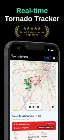
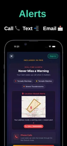
If a warning is active, the app can show its boundary on a map, along with county and affected-population information. I like that the map and local view address two different practical questions: what area is under an alert, and does it include the place I care about? The app also describes phone calls, SMS and email alerts for saved locations, a useful option for people who cannot keep a radar screen open all day.
More Than a Weather App
A basic weather app is usually the quicker choice for checking tomorrow’s temperature or whether to carry an umbrella. Tornado Tracker has a narrower focus and goes much further into severe weather: warning boundaries, radar layers, outlook maps and a substantial tornado archive all sit alongside local conditions. That extra detail can be valuable when storms are a real concern, but it is not the simplest option for someone who only wants a compact daily forecast.
It is also not a replacement for primary warning systems. The app explicitly describes itself as a complement and recommends NOAA Weather Radio as backup. I would treat it as a way to explore alerts and risk, not as a reason to ignore other reliable sources or assume one app covers every need. Its US-and-Canada focus, and the US-only Pro plan, are worth keeping in mind for people elsewhere.
Make the Detail Useful
The app offers a lot to browse, so I would start with one location that matters most rather than trying to follow every map and statistic at once. A saved address makes the Local tab more relevant, while filters for alert type, state, country and time period can narrow the live-warning view. Pro supports monitoring up to five locations, which could help someone keep an eye on home and other important places.
On a quiet day, the guides offer a sensible way to learn the interface without waiting for severe weather. Topics include the difference between a watch and a warning, how to read the map and what radar types mean. I’d also use the archive and outlooks when I have time to explore, rather than treating every chart as an immediate alert. The result is a more manageable routine: check local risk, then dig into detail when useful.
More From Our News Desk

Zoom Meetings, Google Meet, or Teams: Which Is Easiest to Join?

How I Build a Free Streaming Lineup With Tubi

Why Crunchyroll Is the Default Anime App for So Many Fans

YouTube TV: A Practical Guide to Cutting Cable

Rummikub and the Small Comfort of Phone Games

TeamViewer Remote Control or AnyDesk for Helping Family?
Who Will Get the Most From It
I’d recommend Tornado Tracker to people in tornado-prone parts of the US and Canada who want to understand alerts in context. Weather enthusiasts, storm chasers, researchers and emergency professionals may also appreciate the detailed maps, outlooks and historical records. The local-address view is especially practical for someone who wants to know whether an active warning affects a specific place rather than relying only on a state-wide picture.
It may be a poor fit if you want nothing more than a quick temperature check or prefer a very simple weather screen. The number of map layers, archive filters and alert types can feel like a lot when all you need is a basic forecast. I’d also be cautious about relying on any single app for urgent warnings; Tornado Tracker itself says it complements, rather than replaces, primary warning systems.
Tornado Tracker by TornadoPath is made by Ridge Labs LLC for iPhone and iPad, with an iOS 15.1 minimum requirement. The App Store rates it 4+ and shows a 4.9 rating from 1,838 ratings. Its current version is 5.1.8. The release date shown is December 9, 2025, and the most recent update date provided is October 16, 2026.
The app is free to download. Its description offers Go Pro for $39.99 per year or $149.99 for a lifetime purchase, with the Pro option described as US-only. Pro features include additional alert delivery and monitoring multiple locations. The available pricing and purchase details are worth checking in the App Store, since they may vary.
A Closer Look at TornadoPath
A Focused First Look
When I first opened the app, the strongest impression was its clear focus: this is built around tornadoes and severe weather, not a general-purpose forecast. The feature set spans live warnings, address-based information, maps, outlooks, an archive and learning guides. That breadth is useful, but it also means I would approach it with a specific question in mind instead of expecting a minimal screen with only current conditions.
Getting oriented can start with the Local tab. Searching a US or Canadian address, or using GPS, connects the weather information to a place that matters to you. The tab can show active warnings, upcoming risk and local conditions, and it includes nearby tornado and warning history. Pro adds the ability to track up to five saved addresses, which may suit people monitoring several locations.
Following Warnings Day to Day
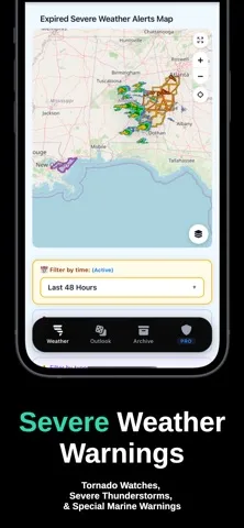
The live-warning view is the app’s central job: it tracks tornado warnings across all 50 US states and Canada, and also covers tornado watches, severe thunderstorm warnings and special marine warnings. Warning polygons help show the affected area, while filters let users narrow results by type, state, country and time. For anyone checking during unsettled weather, those options make the information more specific than a single undifferentiated alert list.
Maps provide another way to understand what is happening. They can display radar and warning boundaries, auto-zoom to warnings and switch between active and expired alerts. Four base styles—Standard, Minimal, Dark and Terrain—let users change the map’s appearance. I appreciate that the design is not limited to a single visual presentation, since a clear boundary and a familiar map style can make a complicated warning easier to interpret.
Details Beyond the Alert
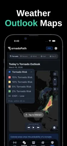
One standout is the range of map layers. The description includes high-definition MRMS radar, predictive forecast radar, echo tops, satellite imagery, precipitation, storm cells, base reflectivity and velocity. These give weather-minded users several ways to examine a storm rather than relying on one radar presentation. The choices are a strength for people who want detail, although a newcomer may need the app’s guides to understand what each layer is showing.
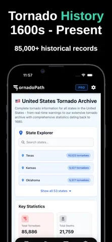
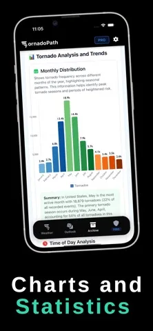
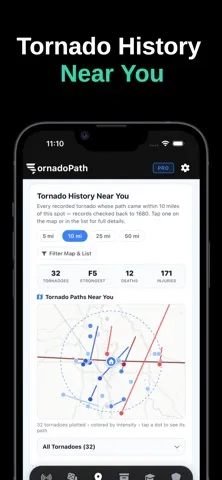
The tornado archive adds a different kind of depth. It includes historical US records dating back to 1680 and Canadian records dating back to 1980, with path maps and filters for intensity, decade, deaths and path length. Users can browse by state, county, province or territory and explore charts and event narratives. I like that this turns the app into a reference tool as well as a way to follow current weather.
A Steady Weather Routine
A practical routine could begin with the address-based view: check whether a warning affects a saved location, then look at the map boundary for geographic context. If the weather outlook is a concern rather than an immediate warning, the app includes day-one, day-two and day-three tornado outlooks, plus tornado, wind and hail probability maps. The Local tab also shows upcoming risk and local conditions, so there are ways to check both the present and what may be ahead.
When I have more time, I’d turn to the learning guides or the archive rather than trying to absorb every map layer during a busy moment. The guides cover topics such as watch versus warning, reading maps, radar types and tornado safety in plain English. For someone building familiarity before storm season, that makes the app’s technical side feel more approachable without removing the detailed tools for experienced users.
Keep Its Scope in Mind
The main limitation is also part of the app’s identity: Tornado Tracker is specialized. A person who only wants a quick daily forecast may find the archive, radar layers and multiple alert categories unnecessary. The app includes local highs and lows, feels-like temperature, humidity and wind, but its feature set is clearly organized around severe weather rather than replacing every function of a broader weather service.
Alert delivery options deserve careful attention, too. The description says Pro provides phone calls, SMS and email, and the plan is US-only. It also says the app complements primary warning systems, not replaces them, and suggests NOAA Weather Radio as backup. I would use those details to set expectations: the app can add useful context and alerts, but it should sit alongside other warning sources.
Tornado Tracker by TornadoPath stands out for putting local warnings, detailed radar, future outlooks and historical tornado records in one focused app. I especially like the address-based view and plain-English guides, which give both practical users and curious weather fans a way into the detail.
I’d recommend it to people who regularly follow severe weather and want more context than a basic forecast supplies. Casual users may prefer something simpler, and nobody should treat it as a sole warning system. Used as a complement, its depth makes a strong case for giving it a try.
Tornado Tracker by TornadoPath Frequently Asked Questions
What is Tornado Tracker by TornadoPath used for?
Tornado Tracker is a weather app for following tornado warnings, watches and other severe alerts in the US and Canada. It also offers address-based local information, radar and warning maps, weather outlooks, learning guides and a historical tornado archive. It is designed to complement primary warning systems, not replace them.
Which devices support Tornado Tracker by TornadoPath?
Tornado Tracker is an iOS app for iPhone and iPad. Its stated minimum requirement is iOS 15.1, and the app is described as optimized for iPad. The available device and operating-system details may change, so it is worth checking the App Store page for current compatibility information before installing.
Does Tornado Tracker by TornadoPath cost money?
The app is free to download. Its description offers a Go Pro plan for $39.99 per year or $149.99 for a lifetime purchase, described as US-only. Pro includes additional alert options and monitoring for multiple locations. Prices and purchase availability may vary, so check the App Store for the current details.
What iOS version does Tornado Tracker by TornadoPath need?
The stated minimum requirement for Tornado Tracker by TornadoPath is iOS 15.1. It is made for iPhone and iPad, with iPad optimization noted in the app description. Requirements can change with updates, so the App Store is the best place to check compatibility for a particular device.
Is Tornado Tracker by TornadoPath suitable for casual users?
It can suit casual users who want to check whether warnings affect a particular address, but its many radar layers, outlooks and archive tools may be more than they need. People in tornado-prone areas and weather enthusiasts are a particularly natural audience. The app should complement, not replace, primary warning systems.
Pros
- Address-based local view connects active warnings and upcoming risk to places users care about.
- Detailed radar layers, outlooks and warning maps offer substantial context for severe weather.
- Historical tornado records include path maps, filters, charts and event narratives.
- Plain-English guides help explain warnings, maps, radar types and tornado safety.
Cons
- The extensive maps and data may feel overwhelming for people seeking a simple forecast.
- Pro alert delivery and multiple-location monitoring require a paid plan.
- The app is designed to complement, not replace, primary warning systems.
- Category
- Weather
- Version
- 5.1.8