Google Earth
- 2.95M
- 3.8
- Installs
- 500.00M
- Price
- Free

Screenshots
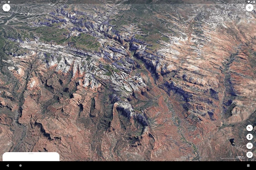
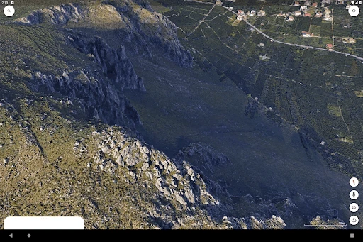
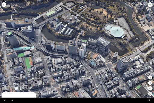
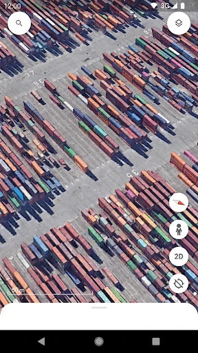
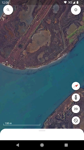
Analysis by Reviewed APKs
Google Earth is a globe for exploring places through satellite imagery, 3D terrain and buildings, and Street View panoramas. I’d recommend it to curious travelers, students, and anyone who likes getting a feel for a destination before visiting. After spending time with it, my take is that it’s most enjoyable as a visual exploration tool: it makes browsing the planet feel immediate, though it isn’t a substitute for a focused trip-planning or navigation app.
A Closer Look Before You Go
When I’m thinking about a trip, I like to look around the destination before I arrive. Google Earth makes that an easy, visual activity: I can zoom in from a broad view of the planet to satellite imagery, then examine terrain and buildings in 3D in hundreds of cities. It gives me a better sense of a place’s shape and surroundings than a quick glance at a name on a map.
Street View adds a different perspective when I want to look at a street or neighborhood from ground level. I can switch from seeing a city’s layout from above to taking in a 360-degree view along a street. That change in perspective is the app’s most useful trick for casual planning. It helps me build a picture of a destination, even when I’m simply curious about somewhere I’ve never been.
Exploration, Not Turn-by-Turn Travel
Google Earth is better understood as a way to examine the world than as a tool for managing the practical details of a journey. Its satellite views, 3D terrain, city buildings, and Street View panoramas are built for looking around. When I want to understand how a place appears from above or at street level, that combination is compelling; it gives exploration more depth than simply scanning a place name.
I wouldn’t treat it as a replacement for a dedicated navigation app or a complete trip planner. The description focuses on immersive maps and visual exploration, not directions, schedules, or bookings. That distinction matters in ordinary use: Earth is where I go to get a feel for a destination, not where I expect to organize every step of getting there. It’s also not a game or a social destination in itself.
Make Browsing More Intentional
I get more out of Google Earth when I start with a question rather than endlessly roaming. It might be as simple as wondering what the coastline looks like, how a city sits among nearby hills, or what a neighborhood feels like at street level. Moving between satellite imagery, 3D views, and Street View gives each question a different angle without making the session feel like a formal research project.
A small habit that works well is to zoom out before jumping to another place. Seeing the wider landscape helps me keep a city, mountain range, or coastline in context, then I can return to the details that caught my attention. I also try not to confuse visual familiarity with firsthand experience. A panorama can show a street, but looking at it on a screen is still a different experience from being there.
Reads About Google Earth
More From Our News Desk

Zoom Meetings, Google Meet, or Teams: Which Is Easiest to Join?

How I Build a Free Streaming Lineup With Tubi

Why Crunchyroll Is the Default Anime App for So Many Fans

YouTube TV: A Practical Guide to Cutting Cable

Rummikub and the Small Comfort of Phone Games

TeamViewer Remote Control or AnyDesk for Helping Family?
Who Will Enjoy Exploring
I’d recommend Google Earth to people who enjoy discovering places visually, whether they’re planning a visit, revisiting a familiar neighborhood from afar, or following a passing curiosity. Travelers may appreciate switching between a wide satellite view and street-level panoramas. Students and geography-minded readers can also use the different perspectives to make landscapes and city layouts easier to picture. The appeal is straightforward: it invites you to look around, not just search for a destination.
It may be less satisfying if your main goal is to get somewhere efficiently or handle the logistics of a trip. The experience described here centers on imagery, terrain, buildings, and immersive maps, rather than the practical tools of a full travel organizer. It also suits patient browsing better than someone who wants a narrowly defined task completed in a few taps. If exploring places on screen sounds enjoyable, its visual approach is a real strength.
Google Earth is made by Google LLC and is in the Travel & Local category on Google Play. It has over 500 million installs and a 3.8-star rating from around 2.95 million ratings. The app is free to download, with no in-app purchases or ads reported. Its content rating is Everyone, so the store classification presents it as suitable for a general audience.
The listed version is “Varies with device,” and the release date shown is February 22, 2010. Google Play gives October 20, 2026 as the last update date. No minimum Android version is included in the available app facts, so Android compatibility is best checked on the Google Play page for the device in question.
Seeing Places From Every Angle
A Globe With Immediate Detail
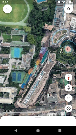
My first impression is that Google Earth makes the planet feel approachable. Rather than starting with a narrow, task-focused view, it invites me to look at the world from above and then move closer to a place that catches my eye. The high-resolution satellite imagery is the foundation, while 3D terrain and buildings give some locations a more dimensional feel.
The experience is strongest when I treat it as visual discovery. A broad view can lead naturally into a closer look at a city, its surrounding terrain, or a street panorama. I don’t need a complicated plan to begin exploring; curiosity supplies the next step. That low-pressure quality makes it easy to open the app for a short look and end up spending longer than intended.
The Pleasure of Looking Around
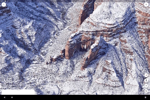
Day to day, the app’s appeal comes from moving between scales. Satellite imagery lets me take in a large area, while 3D terrain and buildings make certain views feel more tangible. Street View then offers a ground-level perspective, with 360-degree views of streets and neighborhoods. Those modes complement one another: each answers a slightly different question about what a place looks like.
I find that this variety keeps browsing from feeling like a single repeated action. A place that looks ordinary from above may become more interesting when I take in its terrain, buildings, or street-level surroundings. The experience remains centered on looking rather than completing a checklist, which is relaxing when I have time to wander. It’s also why I wouldn’t open it expecting the same kind of direct guidance as a navigation-focused app.
Views That Change Perspective
The standout feature is the way Google Earth combines satellite imagery with 3D views and Street View. I can approach a place from above, notice its wider setting, and then explore a street or neighborhood in a 360-degree panorama. That shift is useful not because it turns every place into a full virtual visit, but because it gives me several ways to understand the same area.
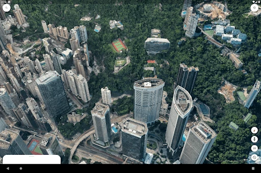
3D terrain and buildings in hundreds of cities add another layer to that exploration. The effect is especially helpful when I’m trying to picture how a city or landscape is arranged, rather than simply identifying a point on a map. The app’s immersive, data-driven maps are also described as something users can create and collaborate on. That makes the mapping side broader than passive browsing, without changing the basic pleasure of exploring.
A Simple Destination Routine
For a practical session, I start with a destination I already have in mind, then look at the surrounding area from above. I take in the broader geography first, because that gives the details a useful context. From there I move closer to examine the terrain and buildings where 3D views are available. This sequence turns a vague question about a place into a more concrete mental picture.
If I’m curious about what a street or neighborhood looks like, I finish with Street View’s 360-degree perspective. I keep the goal modest: get a sense of the setting, rather than trying to plan every part of a visit from the screen. This routine works for a future destination, but it also suits an idle moment when I simply want to see what a distant place looks like. The app rewards curiosity without requiring a lengthy setup.
Keep Its Role in Mind
The main limitation is also part of the app’s identity: Google Earth is designed around visual exploration. If I need a tightly focused tool for directions or trip logistics, the features described here don’t make it a one-stop answer. I have to bring a little patience and decide what I want to look at. That open-endedness is pleasant for browsing, but less useful when I’m in a hurry.
Another thing to keep in mind is that the experience varies by place. The description specifies 3D terrain and buildings in hundreds of cities, rather than promising that every destination has the same level of detail. Street View and satellite imagery provide different kinds of context, but neither is the same as being there. I use Earth to explore and form an impression, not to assume a screen view tells me everything about a location.
Google Earth makes a convincing case for slowing down and looking at the world from more than one angle. Satellite imagery, 3D terrain and buildings, and Street View panoramas combine into an inviting exploration experience. I especially like it for getting oriented to a destination or following curiosity, rather than trying to make it handle every part of a trip.
I’d recommend it to travelers, students, and anyone who enjoys visual discovery. If you mainly want direct navigation or tightly organized travel planning, its focus may feel too open-ended. For a free app without ads or in-app purchases, though, it’s an appealing way to explore places from home and build a better sense of their surroundings.
Google Earth Frequently Asked Questions
What is Google Earth used for?
Google Earth is used to explore places through high-resolution satellite imagery, 3D terrain and buildings in hundreds of cities, and Street View’s 360-degree views of streets and neighborhoods. It also supports creating and collaborating on immersive, data-driven maps. It’s best suited to visual discovery and getting a sense of a location, rather than serving as a complete travel planner.
Which devices can run Google Earth?
Google Earth is available on Android through Google Play. The available app details don’t specify a minimum Android version, so compatibility can vary by device and is worth checking on the Google Play page. The listed version is “Varies with device.” Check the store information for the device you plan to use.
Does Google Earth cost anything?
Google Earth is free to download on Google Play. The available facts report no in-app purchases and no ads. Store details can change over time, so it’s worth checking the current Google Play page if you want to confirm the terms before installing.
Does Google Earth need a particular Android version?
The app facts don’t provide a minimum Android version. Google Play compatibility can depend on the device, so check Google Earth’s store page from the Android phone or tablet you plan to use. The version is listed as varying with device, rather than as one fixed version for every user.
Who is Google Earth best for?
Google Earth suits people who enjoy exploring destinations visually, including travelers who want a feel for a place and anyone curious about geography or neighborhoods. It may be less suited to people seeking a focused directions tool or a complete trip organizer. Its main emphasis is immersive maps, imagery, 3D views, and Street View exploration.
Pros
- Combines satellite imagery, 3D views, and Street View for varied perspectives.
- Makes casual exploration of cities, terrain, streets, and neighborhoods inviting.
- Free to download, with no ads or in-app purchases reported.
- Supports creating and collaborating on immersive, data-driven maps.
Cons
- Its visual exploration focus may not suit people seeking trip logistics or directions.
- 3D terrain and buildings are available in hundreds of cities, not everywhere.
- Browsing is open-ended, which can feel less direct when you have a specific task.
- Category
- Travel & Local